Mt. Daisen climbing record
For this climb Exertion Level:★☆☆☆☆ Difficulty Level:★☆☆☆☆ Scenic Level:★★★★☆
For this climb
Exertion Level:★☆☆☆☆
Difficulty Level:★☆☆☆☆
Scenic Level:★★★★☆
This Mountain's Information
Schedule
- □ Duration:1 Day
- □ Term of Climbing:10.22.2016 ~ 10.22.2016
- □ Date at Summit: 10.22.2016
Weather
- □ Weather:Cloudy
- □ Highest Temperature:19.0°C
- □ Lowest Temperature:9.0°C
Climbing Course
- □ Distance:8.3km
- □ Cumulative Elevation:950m
- □ Course:Climed the Summer Course and went down via the Mototani Walking Course.
- □ Further Information:I think this course is not difficult for everyone. During climbing, I could see the beautiful sea. This course we can see with sea, was a good choice.
Approach to Starting Point
- □ Transportation:Airplane
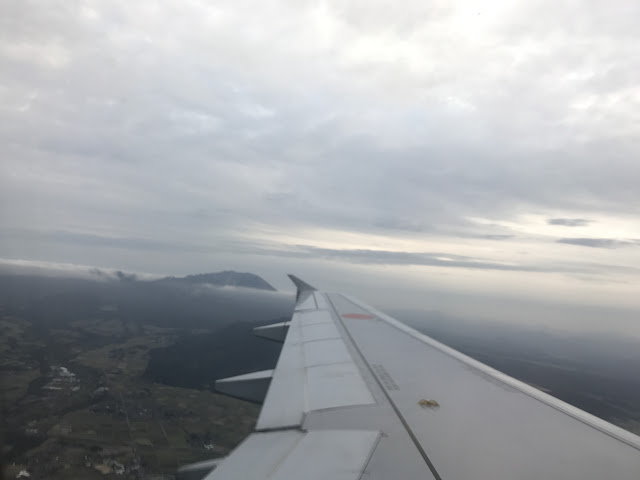
- □ Time to Starting Point:One and half hours by each plane and car
- □ Further Information:From Omiya to ANA hotel of Tottori Prefecture via Haneda Airport.
Location
The Map of Climbing Course

Altitude × Temperature

Download GPS Data
My Impressions
This mountain's name is Daisen and in Kanji it is written as 大山. There is another mountain that is written in the same way, but the pronunciation is Oyama, so they can be easy confused. Mt. Daisen is far from here, so I had to get on a plane in order to get there. Unfortunately, two hours before my departure, there was an earthquake in Tottori prefecture of 6.5 magnitude. For this reason, I was hesitant to get on a plane, but I had no choice because I had already finished the check-in. Fortunately, Yonago City, the place nearest to Daisen mountain, was not seriously affected by the earthquake, so I was able to get there without any difficulties.
The climbing path was man-made and it didn't look natural, so I couldn't enjoy climbing as much as usual, but the scenery was beautiful. I think that the mountain is not intended to be a climbing challenge, but it is perfect for enjoying the natural surroundings. I think this course is easy and suitable for everyone. During climbing, I could see the beautiful sea. This course we can see with sea, was a good choice.
When it comes to foods, I was impressed by sushi I ate there. I've never ate such fresh and delicious Sushi at such an incredible low price. The other seafood was also amazing! I also enjoyed nice views of Mt. Daisen when I was driving along the coast. Besides the climbing, there's also many other things to enjoy at Tottori prefecture. Come and find out for yourself!
Video Gallery
Photo Gallery
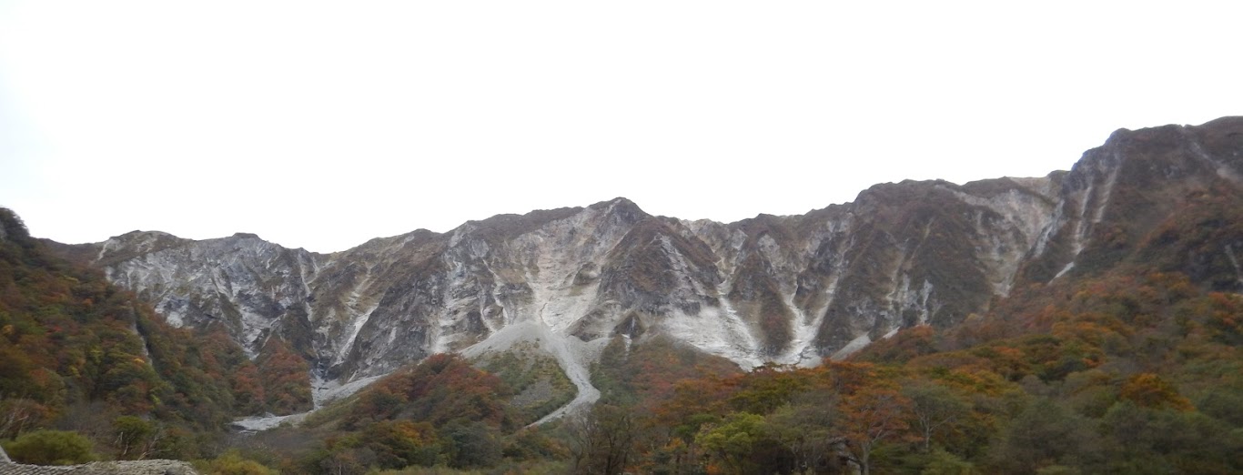
That's my target to climb tomorrow.
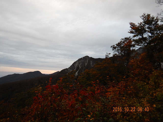
It was the climax season of autumn colors.
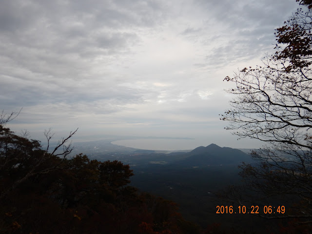
The sea, mountains, everything that we can enjoy nature is here, Yonago City.
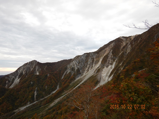
It looked snowed, but it's just white rocks. I suppose the rocks have changed its color by volcano.

Sometimes I could hear big sound that rocks fall down.

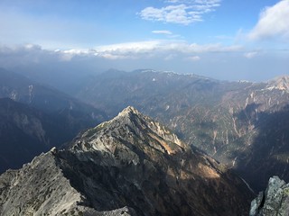
I could see the scenery the south sides of this mountain, but shortly.
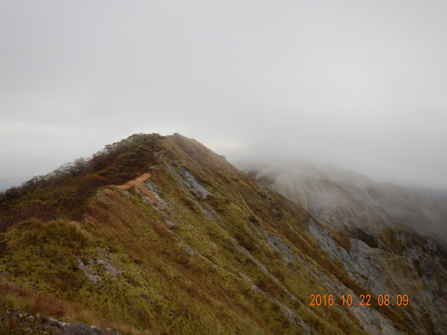
That path have not allowed to walk. But I have ever seen the picture that some people was walking that path on deep snow.

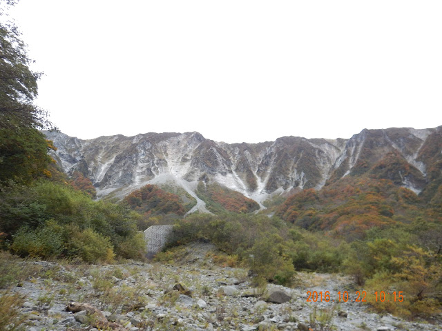
There are some different color of leaves.
Someday, I'll come again and walk the ridge-line when it covered with snow.
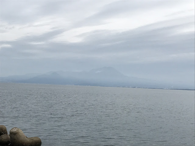
I took this picture from the coast which is far from 30km apart.