Mt. Yatsugatake climbing record
For this climb Exertion Level:★★★☆☆ Difficulty Level:★★★☆☆ Scenic Level:★★★★☆
For this climb
Exertion Level:★★★☆☆
Difficulty Level:★★★☆☆
Scenic Level:★★★★☆
This Mountain's Information
Schedule
- □ Duration:2 days and 1 night
- □ Term of Climbing:01.01.2017 ~ 01.02.2017
- □ Date at Summit: 01.02.2017
Weather
- □ Weather:Mostly Sunny
- □ Highest Temperature:3.0°C
- □ Lowest Temperature:-7.0°C
Climbing Course
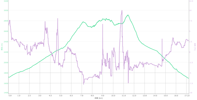
- □ Distance:17.2km
- □ Cumulative Elevation:1,500m
- □ Course:From Akadake Kosen to Gyozagoya vis Mt.Io, Mt. Yokodake, Mt. Akadake
- □ Further Information: As I advanced forward from Mt. Io to Mt. Yokodake, conditions became worse. The path became narrow, steep, icy, etc. When the wind was strong, I had to stop and maintain balance so as not to slide down. Because of the lack of snow, I could seize chains that were already set up when I climbed steeper parts. But, in this season the chain is usually hidden under the snow so it can be very difficult to climb. I was lucky!
Approach to Starting Point
- □ Transportation:Car
- □ Time to Starting Point:About 4 hours one way but I stucked by terrible traffic jam so it took about 6 hours.
- □ Further Information:From Omiya to Suwa IC via the cetral highway
Location
The Map of Climbing Course

Altitude × Temperature

Download GPS Data
My Impressions
Mt. Yatsugatake consists of some different mountains like Mt. Akadake, Mt. Yokodake, Mt. Amidadake and so on. "Yatsu" means eight in Japanese. The highest mountain among Yatsugatake area is Mt. Akadake. I had wanted to climb this course for a long time. This course is the ideal way to enjoy all of Yatsugatake
It was a difficult climb to plan. The climb demands 3 days and specialist skills and equipment, especially in mid winter. Finally, this winter, the chance was came.
Unexpectedly, I found the climb easy. The weather, no wind and high temperature, made for comfortable conditions. Such good weather is rare in this region at this time. I had never had such good luck with nice weather on New Year's Day before.
This week is usually the harshest week of the Japanese winter.
After completing this climb, the only remaining mountain in Yatsugatake area is Mt. Amidake. I'll tackle it next year!
Video Gallery
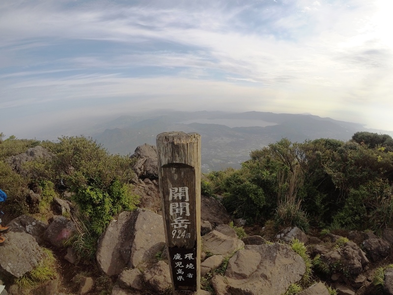
Photo Gallery
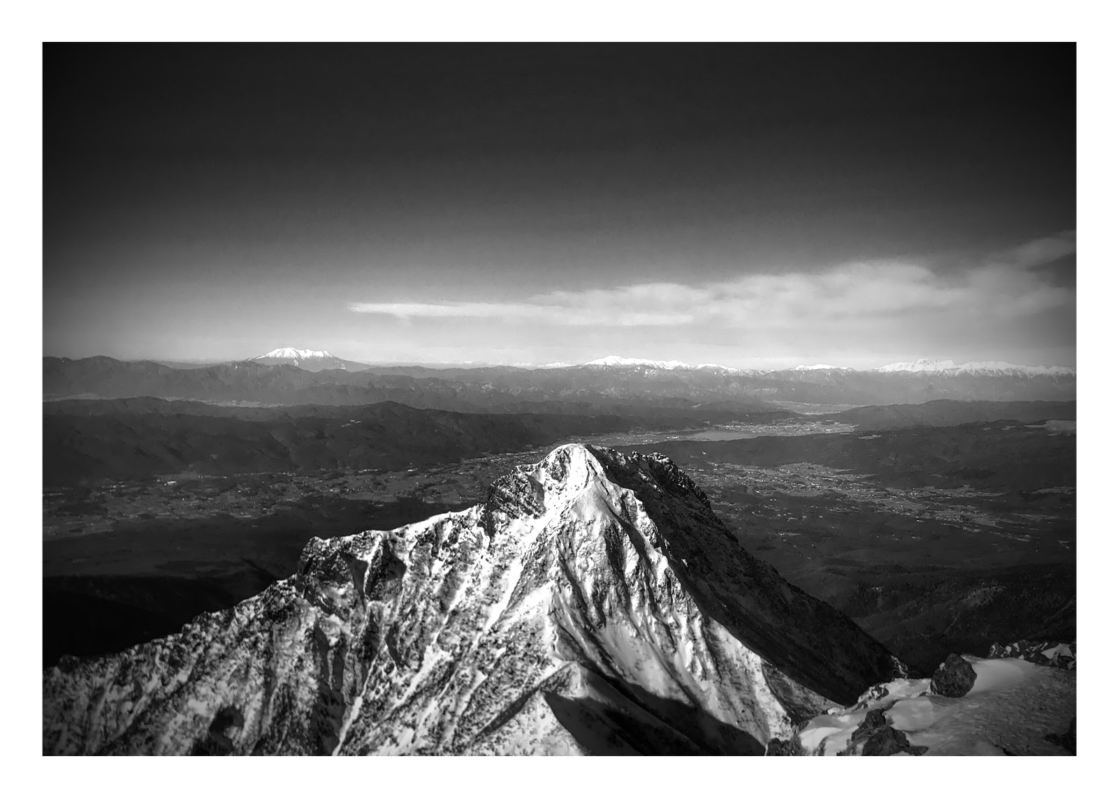
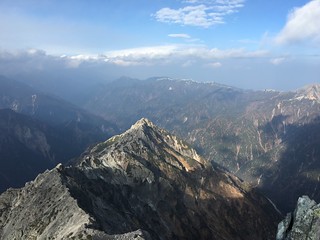
This is the Mt. Amidadake that I took from Mt. Akadake.

We call this stuff Ice Candy. We can rehearse ice climbing at a cost of 1,000 Yen.

This is the second sunrise of this year!

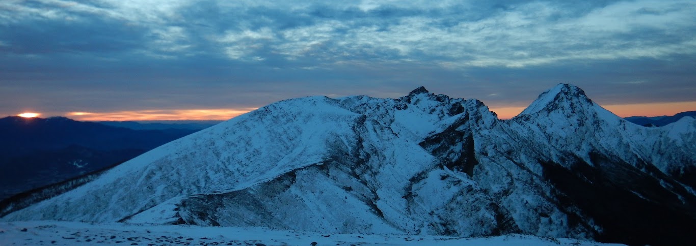
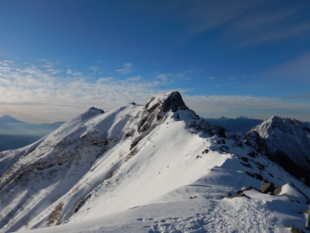
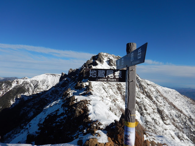
Looking at Mt. Yokodake and Mt. Akadake from Mt. Io.
I got to the ridge line without difficulty. I would encounter difficulty from here.
I love walking on a ridge because I can enjoy nice scenery all the time.
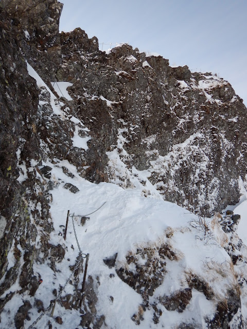
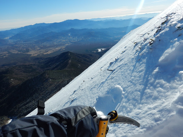
When I climbed this rock, I felt nervous little bit. My ice axe and the chain were helpful.
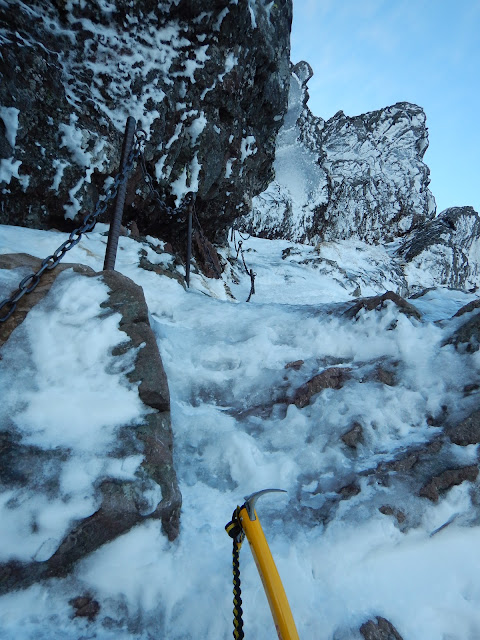
Sometimes I couldn't pierce the ice with my ice axe because it was so hard.
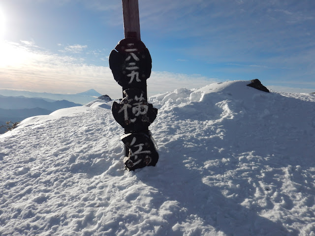
I suceeded to climb Mt. Yokodake.
Very good scenery. I wanted to see it.
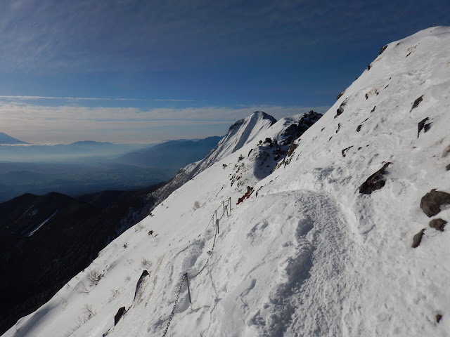
These paths are dangerous when strong winds blow.
I heard from the news that someone who climbed this mountain slipped down, yesterday. I also heard that fortunately she had been rescued, by helicopter.
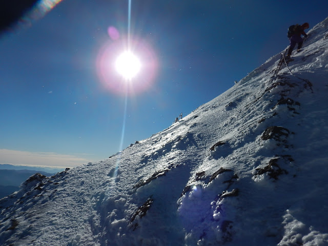
I almost got to the summit. It's pretty steep here.
There remains dozens of meters to get to the summit.
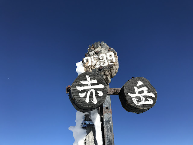
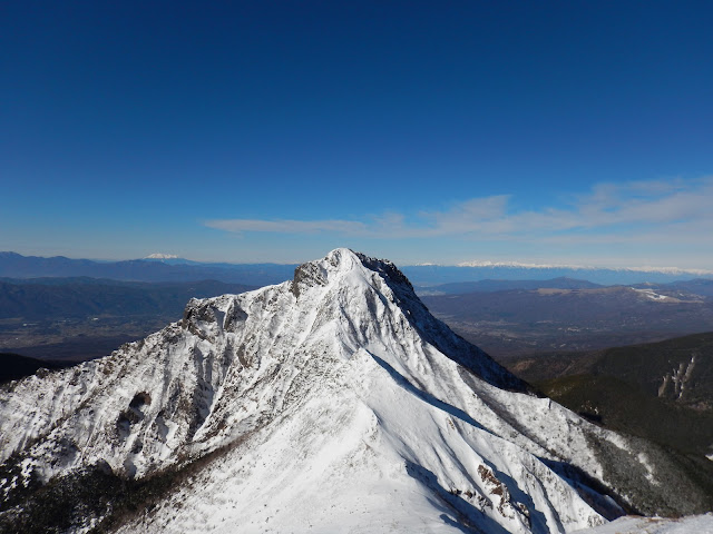
I love this angle I always take it when I climb this mountain.
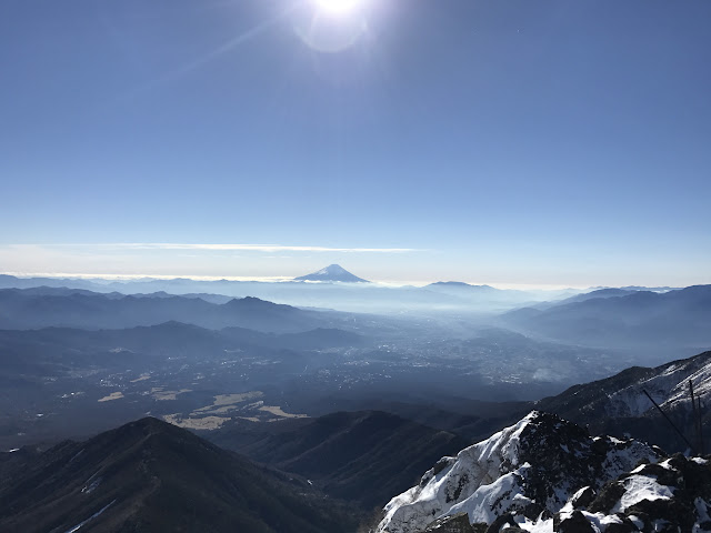
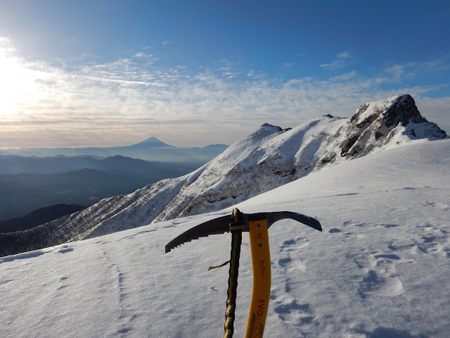
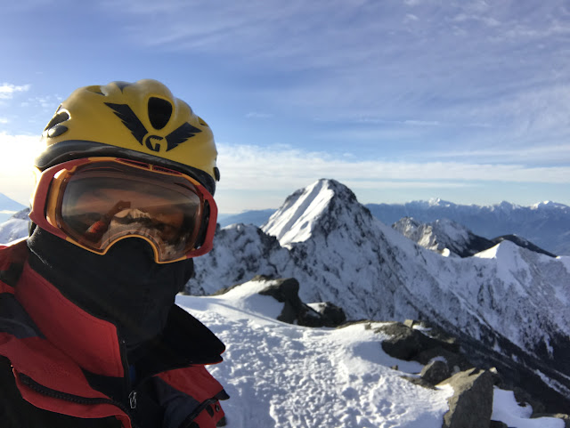
I could see Mt. Fuji and all of the Alps of Japan.
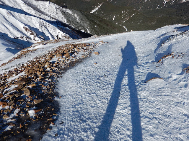
I'm going to go down to the valley using my long legs.
My next target climb in Yatsugatake area.
It was a perfect trip that was favored by good weather.