Mt. Tanigawa-Bateikei climbing record
For this climb Exertion Level:★★★★☆ Difficulty Level:★★☆☆☆ Scenic Level:★★★☆☆
For this climb
Exertion Level:★★★★☆
Difficulty Level:★★☆☆☆
Scenic Level:★★★☆☆

This Mountain's Information
Schedule
- □ Duration:1 Day
- □ Term of Climbing:12.03.2016 ~ 12.03.2016
- □ Date at Summit: 12.03.2016
Weather
- □ Weather:Mostly Sunny
- □ Highest Temperature:17.0°C
- □ Lowest Temperature:0.0°C
Climbing Course
- □ Distance:23.7km
- □ Cumulative Elevation:1,849m
- □ Course:From Mt. Shiragamon to Shirakaba Ridge via Mt. Asahidake and Shimizu-Toge
- □ Further Information:Climbing toward to Mt. Shiragamon was terrible because of bad conditions. -- There was just a little snow, a steep path, not much of a view... It was so boring. After Mt. Shiragamon, the snow got deeper and deeper, so I expended a lot of energy. I struggled to conserve my energy during this climb.
Approach to Starting Point
- □ Transportation:Car
- □ Time to Starting Point:About 3 hours one way
- □ Further Information:From Omiya to Bridge Doai via Minakami IC of Kanetsu highway.
※Don't worry about the parking space. there is a really big parking lot next to Bridge Doai.
Location
The Map of Climbing Course

Altitude × Temperature

Download GPS Data
My Impressions
Bateikei means horseshoe-shaped in Japanese. There are some famous mountains one after another, and the line of summits makes a half-circle shape, a horseshoe. Hence the name. The Kanetsu highway tunnel is over 10 km and goes through and under the mountains. It is also located on the border between Gunma prefecture and Niigata prefecture. Especially in winter, we can see completely different scenery on each side of the borderline between the two prefectures because of deep snow. The snow becomes suddenly gets deeper as we go toward to Niigata prefecture.
Mt. Tanigawadake is also called The Mountain of Dead. Almost thousand people have died on this mountain because of the severe weather conditions. In this area conditions are subject to sudden change. Making it a very dangerous place for the name Mountain of Death. Despite the fact that it only has an altitude of just under 2,000m, I wouldn't recommend this climb for inexperienced mountaineers.
This time, Mt. Tanigawadake was not my target. I wanted to challenge myself to go around the Bateikei in one day. In winter, no one enters this area, so I had the beautiful scenery all to myself. After getting to Mt. Asahidake. Mt. Shiragamon is the best place from which to see Mt. Tanigawadake. And I could see the big shape of the ridgeline at Mt. Asahidake. After walking over 15 hours, I was completely exhausted. But I didn't give up. It was worth the effort.
Video Gallery
Photo Gallery

I started early, because I knew I had to walk a long time on a long course today.

No snow! Why did I come? For what?
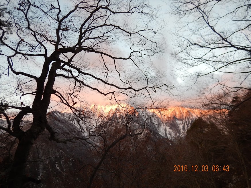
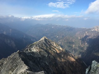
Mt. Tanigawadake was burning by the magic hour's light.

There was no chance to see the summit of Mt. Tanigawadake due to bad weather.

That's a shame!
But, it's ok. I enjoyed the view of Batekei; it means horseshoe-shaped.

After Mt. Shiragamon, the ridge line lasted for a long time.

I love walking these paths.

Mt. Asahidake, which is today's the highest mountain, was far from here so I could not see it.

Here's a deep place. Can I get back home from here?!?! But, there's no option to give up for survival.

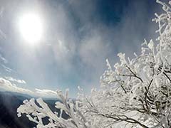
Ice and snow mixed. It looks like a monster.

I was in the middle of Batekei. It would not be easy going back.

Here's the summit of Mt. Asahidake which is designated as one of the 200 Famous Mountains of Japan.
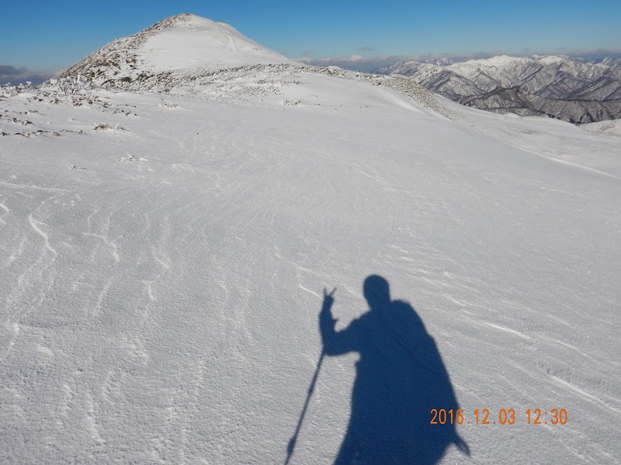
Nobody took my photo, so I did it by myself.

If I had a enough time, I would climb that mountain called Mt. Makihata, I climbed two years ago.

I gradually felt tired. But I had to walk without breaks.

I couldn't go on walking without a break. It was harsh.

The harshest time of that day got started. I had to use a rope in the dark.

If the lodge for emergency was clean, I would stay there. I had stamina to get to the parking lot, so I kept going.