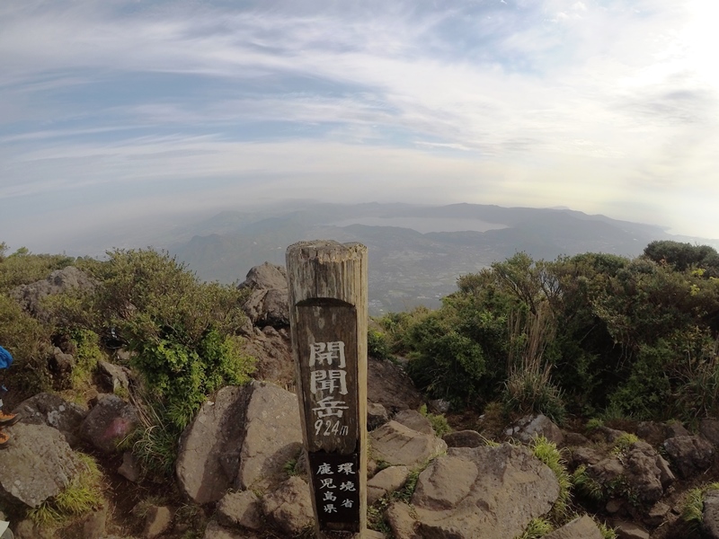
Mt. Yakedake climbing record
For this climb Exertion Level:★★☆☆☆ Difficulty Level:★★★☆☆ Scenic Level:★★★★☆
For this climb
Exertion Level:★★☆☆☆
Difficulty Level:★★★☆☆
Scenic Level:★★★★☆
This Mountain's Information
Schedule
- □ Duration:1 Day
- □ Term of Climbing:04.22.2017 ~ 04.22.2017
- □ Date at Summit: 04.22.2017
Weather
- □ Weather:Mostly Sunny
- □ Highest Temperature:8.0°C
- □ Lowest Temperature:3.0°C
Climbing Course
- □ Distance:8.4km
- □ Cumulative Elevation:945m
- □ Course:New Nakanoyu Course
- □ Further Information:・Time Schedule
9:13 Nakanoyu Hotel → 9:30 Climbing Entrance → 11:08 The Square → 11:56 Starting Traverse to North Peak → 13:00 Summit (North Peak) → 13:25 starting descent → 13:47 The Square → 14:44 Nakanoyu Hotel
・Course Conditions
From starting point to The Square, the path made by others was not clear. But, there's no risk of getting lost because if you just start going up, eventually you’ll see a clear path, so I chose the path where I can walk easily.
Because of the melting snow, sometimes my crampons didn't work. There was high risk of slipping down.
・Clothing
There was no wind and it was pretty warm, so I spent the whole climb with my wool T-shirt and thin softshell.
・Equipment
I didn't need to use snowshoes. It’s enough to carry just crampons and a snow axe.
※ You should not stay long near the sulfur gas below the summit. — I was about to lose consciousness because of the dense gas.
Approach to Starting Point
- □ Transportation:Car
- □ Time to Starting Point:About 4 hours one way by car
- □ Further Information:From Omiya to Suwa IC via the cetral highway
※ There was enough space to park, even if you are not staying at the hotel. But, be aware in summer season will be crowded with other climbers.
Location
The Map of Climbing Course

Altitude × Temperature

Download GPS Data
My Impressions
This was second time to climb Mt. Yakedake (You can find that record on the list of December 2016) In December, I failed to summit. but, I succeeded getting to the summit this time. I summited, but I found it was not so easy. To succeed with this climb, walk the center path(curl) between the north and south peaks. It wouldn't be difficult to get the summit, but there is a risk of avalanches. In order to reduce that risk, I took alternate route when I climb. It made the climb much more difficult because I had to traverse an amazingly steep path. I decided to take the risk of going back down on the center and it only took 20 minutes to cover the same distance it took two hours to climb on the way up! (Again, this is risky, so use your best judgement.)
There were no traces made by others on both routes, so I guess I was the first to summit the north peak that day. This course is definately not for beginners. That's why I gave it three stars for Difficulty.
It is really interesting climb because it has completely different aspects depending on season and it has a number of different possible routes. You have to wait and read the conditions when you get there and then decide your route. I really like this type of climb. I'm looking forward to climbing Mt. Yakedake again and seeing how I can do it next time.
Video Gallery
Photo Gallery

This gate was just opened a couple of days before. It's the starting point of the climbing by car. And it closed every winter.

I first came here about four months ago. This is a really good hotel in terms of price and good service. I recommend staying here if you come to the Northern Alps Japan.

This climb was my first time taking a beacon. It can help helicopter rescuers find me if I have an emergancy.
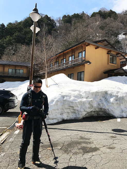
I'm ready. Are you ready? Let's get started!!!

There was less snow and it was not as fresher as when I came here last time.

There are not many cars at the parking lot at the entrance of the climb, so it won't be crowded today.

Amanatto, I love this stuff. Dried soy beans containing plenty of nutrition for climbing, it doesn't take a lot of space, it's light and easier to eat than rice, and as a bonus, it tastes good.

The snow was accumulated much more than in December, but it was not fresh any more.

I could find my goal just 2 hours from start. But, I know it is never as close as it looks.

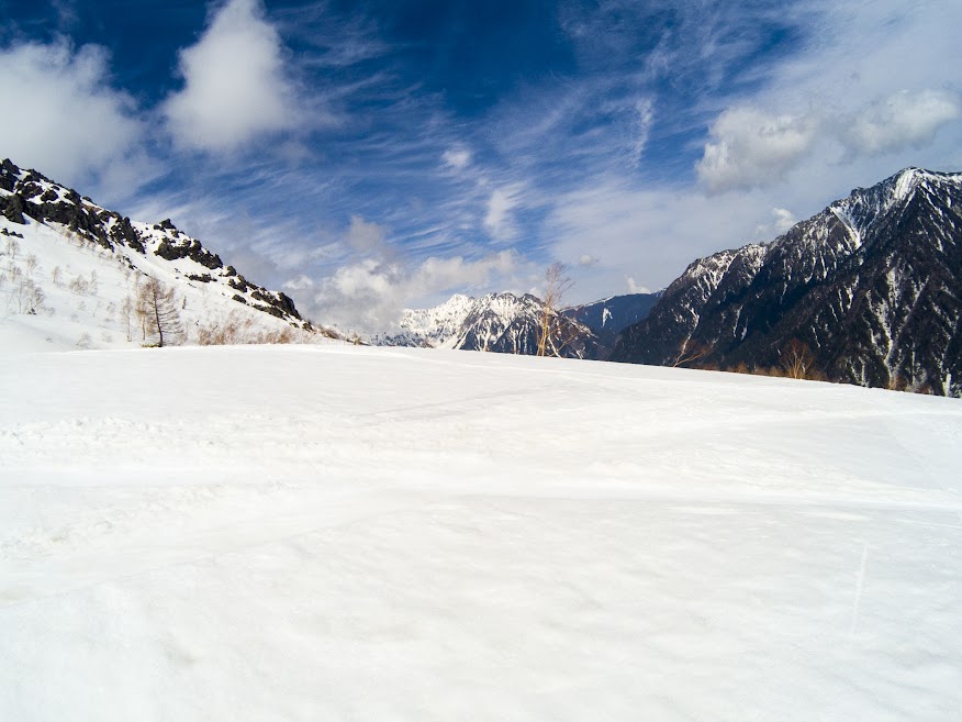
There is a large open space on the mountain, so we call it The Square (Hiroba in Japanese.) Someone else was preparing to put up their tents at this point.

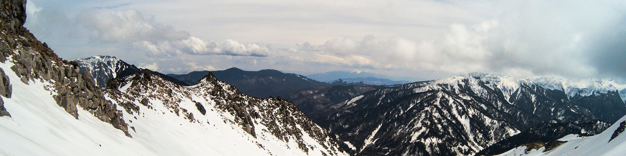
I wondered if I could get a good veiw from the summit. -- This area's weather is really changeable.

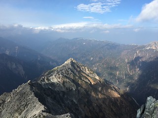
The distant mountain on the left is called Mt. Mae-Hotaka, and right side one is called Mt. Myojindake. I have not climbed either of them, yet.

At the center rgiht is the South Peak, and on right side is the North Peak of Mt. Yakedake. I didn't realize it is better to walk between the two peaks at the time.

People say there is a risk of avalanches. But I don't think so today because there's less snow. Can you see the sulfur vent?

At this point I got on my crampons. I couldn't keep my balance any more without them.

I think this is the biggest sulfur vent. The gas was almost unbearable but, at same time I love this smell!!
When I was surrounded by the gas and had to take a deep breath, I almost lost consciousness. But I love that smell.

That's the south peak of this mountain. I succeeded to go through that steep path from the ridge of south peak.

Do you think begginers can go through these paths? It's a good idea to try it. But, call someone to rescue you in advance, if you are a begginer.

This hole would have over ten meters of deepness. I have don't idea if I slip down to there. Just one thing that I know is that I can avoid the strong, cold wind until the helicopter rescuer find me out.

My GoPro is working well. It seems to need a tripod.

I cleared my today's goal. Let's take a nap because there's no views and I love this smell from sulfur vent!!!

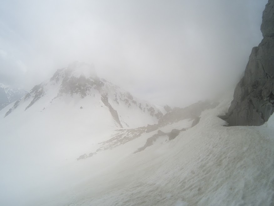
Oh my got!!! All mountains hid behind the clouds.

I wanted to show and tell you that's Mt. Yari and Mt....... something like that with this picture. But, the clouds is inturrupting me to show you how the Northern Alps is beautiful.
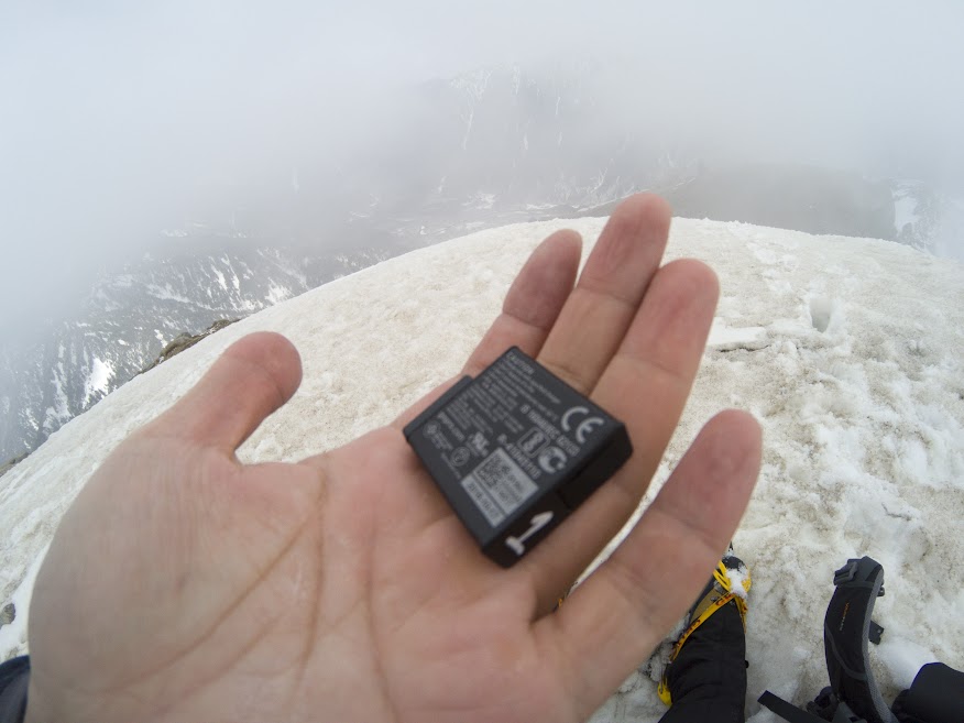
It's a time to use the battery number 2 for my GoPro. This battery doesn't last long. That's incredibly annoying to carry 4 batteries for every climb.

It's time to go back home.

How difficult to walk with my crampons this path is. But, removing them is waste of time.

I decided going bak via the curl. I didn't want go through the steep path which is the right hand side any more.

Move, Move and Run, Run to the hotel!!!
Unbelievably, it just took twenty minites from the summit to The Square. But it took over two hour to climb it to cover the same distance.

I think that dirty stuffs are pollen. It seems Nagano Prefecture also got started the pollen season that I hate.

The sky completely broke out when I got to the hotel. What rotten luck!

Here is a hot sping we call The Secret Hotspring. Pretty much people can't get to there besides climbers because it needs to walk a couple of kilometers to get there.
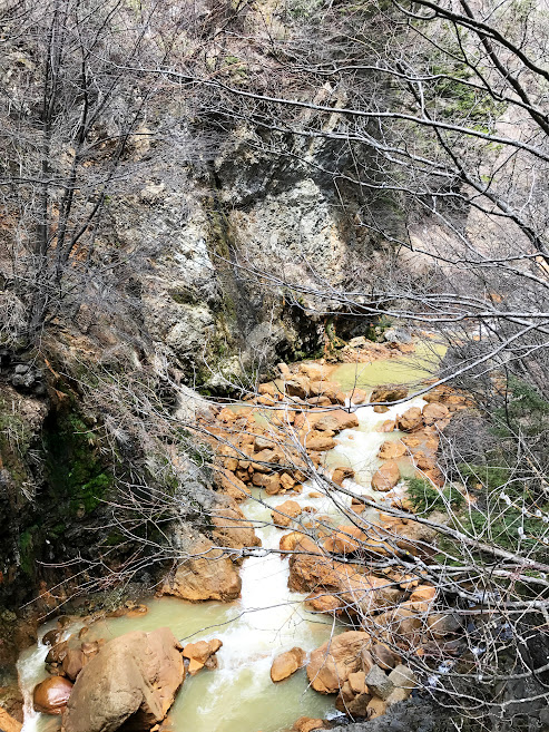
It looks nice!!! I love these type of hotsprings because it smells the sulfur that I love.

I took this picture with my GoPro through a telescope which is already set up in the hotel. Squirrel had been having a breakfast when I found him.