Mt. Ibuki climbing record
For this climb Exertion Level:★★☆☆☆ Difficulty Level:★☆☆☆☆ Scenic Level:★★☆☆☆
For this climb
Exertion Level:★★☆☆☆
Difficulty Level:★☆☆☆☆
Scenic Level:★★☆☆☆

This Mountain's Information
- □ Altitude:1,377m
- □ Location:Ueno, Maibara, Shiga Prefecture (Click to view larger map)
Schedule
- □ Duration:1 Day
- □ Term of Climbing:04.30.2017 ~ 04.30.2017
- □ Date at Summit: 04.30.2017
Weather
- □ Weather:Mostly Sunny
- □ Highest Temperature:12.0°C
- □ Lowest Temperature:8.0°C
Climbing Course
- □ Distance:2.3km
- □ Cumulative Elevation:140m
- □ Course:The Ibuki Drive-way Course
- □ Further Information: Time Schedule : 09:48 Ibuki Drive-way - 10:10 Mt. Ibuki summit - 10:52 Parking lot
Approach to Starting Point
- □ Transportation:Car
- □ Time to Starting Point:About 7 hours one way by car
- □ Further Information:From Omiya to Mt. Ibuki Drive-way via Tomei highway and Tokai-Hokuriku highway.
※ The Drive-way is open at 8:00 and it could be closed when the road is covered with snow.
Location
The Map of Climbing Course

Altitude × Temperature

Download GPS Data
My Impressions
This trip was the first time I got to use some new GoPro equipment. A 360-degrees rotating tripod for time-lapse filming. The time-lapse function makes for really interesting videos. Take a look at the awesome videos that I took at the summit. I'm looking forward to using it again for my future climbs.
I think this mountain might be the easiest mountain to climb of the one hundred mountains, if you use the Drive-way by car. My climb took just 20 minutes! That's why this place is so popular for families. And at the summit, I could see the huge lake Biwa the largest lake in Japan. I recommend climbing this only in good weather. Because the Drive-way is expensive to use. -- it costs about ¥3,000 — so it would be a waste of money if you go in bad weather.
After the short climb, I went to Biwa Lake to see the sunset. It’s so big that it looks like a sea. This place is not so far from Kyoto or Nagoya, so I believe you can fit in some more sightseeing into your trip. Should you wish to.
Video Gallery
Photo Gallery

Last night, I stayed at a hotel near Mt. Ibuki. The sun was setting behind Mt. Ibuki.

Signs that have been put up with a caution 'There is a lot of snow.' Really?

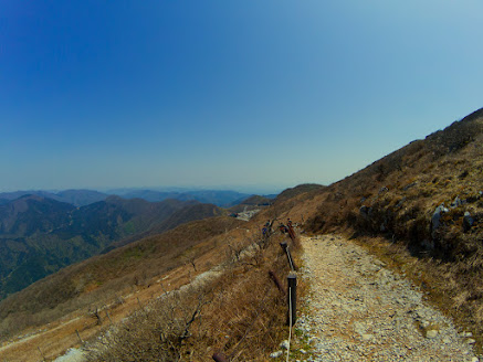
The path was well maintaned.

The weather was also perfect.

It took under one hour to summit from the parking lot. The climb was super boring.

The people who don't use The Ibuki Drive-way would climb that ridge line.

Is that a lot of snow? Are you kidding? What was the sign for?

The summit was large enough to play soccer.

This signs were confusing, so I had to go back when I realized that I took the wrong way.
I didn't know where I was.
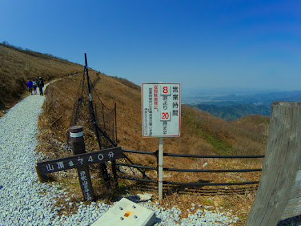
I realized I wasn't actually lost.

This says 'The holy ground of love.' I've seen the same plaque twice in Nagano prefecture and Gunma prefecture. I think Japan loves this plaque.

For once, I actually know what kind of flowers it is. Tulips in front of Anegawa hot spring.

Anegawa hot spring was clean and has big baths.

Here's Biwa lake. It is the biggest lake in Japan, so it looks the sea!

This is my favorite picture from that day.

The sunset was also beautiful.

Isn't he a knockout? It's me.