Mt. Jonendake climbing record
For this climb Exertion Level:★★★☆☆ Difficulty Level:★★★☆☆ Scenic Level:★★☆☆☆
For this climb
Exertion Level:★★★☆☆
Difficulty Level:★★★☆☆
Scenic Level:★★☆☆☆

This Mountain's Information
Schedule
- □ Duration:2 days and 1 night
- □ Term of Climbing:12.23.2016 ~ 12.24.2016
- □ Date at Summit: Unable to Summit
Weather
- □ Weather:Sunny
- □ Highest Temperature:16.0°C
- □ Lowest Temperature:-5.0°C
Climbing Course
- □ Distance:27.2km
- □ Cumulative Elevation:1,650m
- □ Course:I started from an entrance gate to Torikawa Rindo and climbed via Mitsumata.
- □ Further Information:There was deep snow, and a long approch. Especially in winter, we can not enter to Mitsumata which is the starting point of this climb if coming by car. So, it would take one more day than usual. And I think the Ichinokura course is better than Mitsumata course because the approach to the starting point is shorter and there's a lodge where we can take a rest just before the summit.
Approach to Starting Point
- □ Transportation:Car
- □ Time to Starting Point:About 4 hours one way
- □ Further Information:From Omiya to Azumino IC via Kanetsu highway
※ I parked in front of the gate of Karasugawa Rindo.
Location
The Map of Climbing Course

Altitude × Temperature

Download GPS Data
My Impressions
This was my second consecutive climbing where I couldn’t summit following my Mt. Yakedake climb. I got irritated by my climbing failures. But, I never doubt my climbing skills. In the both of climbing, I had enough of both stamina and time. I thought that even if I got to the summit, I'd not be able to enjoy a good scenery because of thick white-out. Basically I just got irritated by the bad weather — although the forecast had said it would be nice weather, unbelievably it had been raining while I walked toward Mitsumata which is the start point to climb and a white-out came when I reached to the ridge line.
The climbing process was not bad. In spite of the deep snow, I could climb as I planed. And I found a good place where I put up my tent. That place was so comfortable and protected from snow and cold weather. At that time, I believed tomorrow will be clear as the weather forecast said and I would succeed with this climb.
I'm going to get this climb back by climbing the same route this summer. Although I love the snow, I'll never walk from Karasugawa Rindo to Mitsumata again. It was so boring to walk and I can go there by car if I go there in summer. That's why I’m choosing summer for this climb next time.
Video Gallery
None of videos for this climb
Photo Gallery
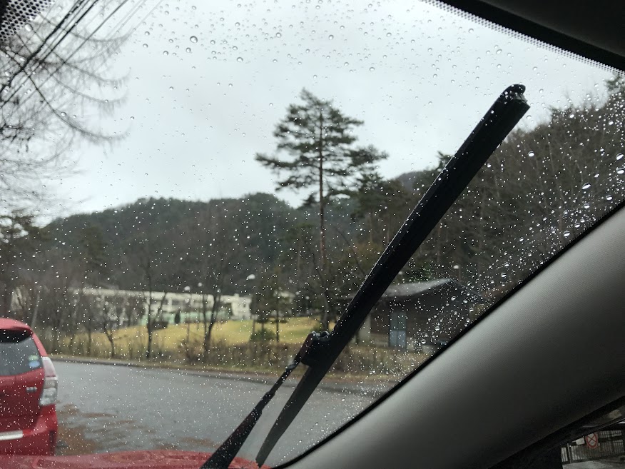
Unbelievable!!! It was a rainy day in December in Nagano Prefecture!!! I was about to go back home because I was so disappointed.

I had to walk about 10km on this forestry road because we can't enter there by car in winter.

The rain lasted to this point and it gradually changed to snow.

Here is the parking lot called Mitsumata. This is the starting point to climb in summer.

Look good? I couldn't eat all of it. SPAM's the best.

I struggled to find the starting point, but I finally got started.
The weather forecast was correct only at this time.

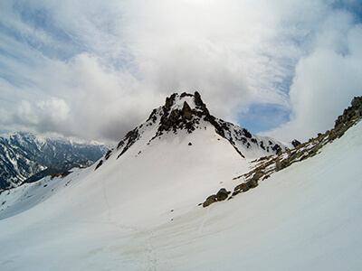
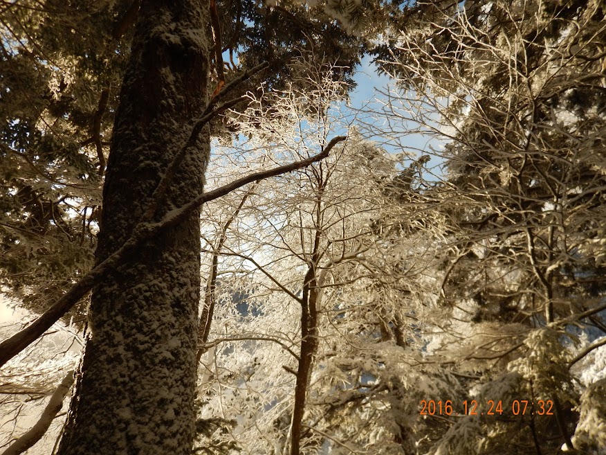
The snow gradually got deeper and deeper as I climbed.

This was the last time that I could see the blue sky.

I was fell down in snow with every step.It was chest deep and like swimming though snow. It took an hour to go one hundred meters.
Suddenly I sank completely down into the snow and realized there was a tree below me. But I didn't know where a tree was because it covered with snow.

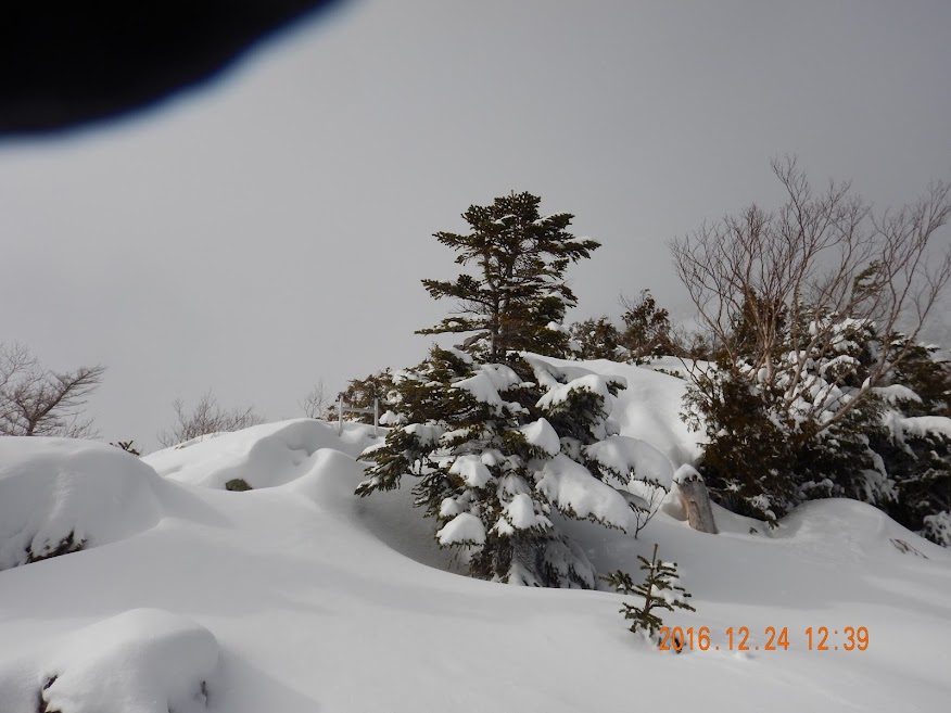
I didn't know clearly where I should go due to the white-out.
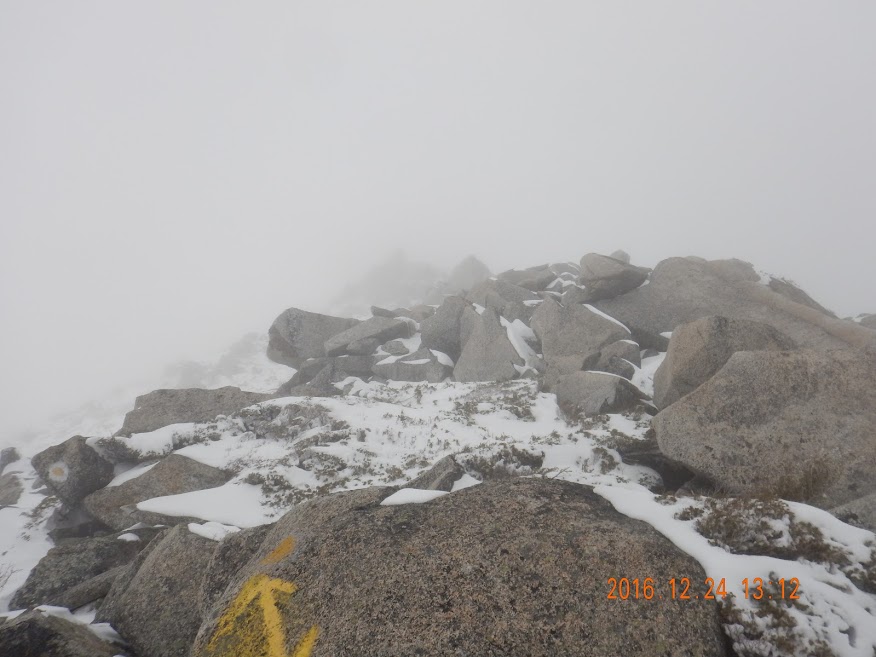
Although I had enough stamina and time, there was no point continuing climbing because of the bad weather. So I turned right back in the direction I came from.

I was hurrying in order to get back to the parking lot before it got dark.

I was so exhausted when I got back to the parking lot. It was such a long approach for one day.