Mt. Senjogatake climbing record
For this climb Exertion Level:★★★★☆ Difficulty Level:★★☆☆☆ Scenic Level:★★★★☆
For this climb
Exertion Level:★★★★☆
Difficulty Level:★★☆☆☆
Scenic Level:★★★★☆
This Mountain's Information
Schedule
- □ Duration:2 days and 1 night
- □ Term of Climbing:03.18.2017 ~ 03.19.2017
- □ Date at Summit: 03.19.2017
Weather
- □ Weather:Mostly Sunny
- □ Highest Temperature:12.0°C
- □ Lowest Temperature:-12.0°C
Climbing Course
- □ Distance:34.7km
- □ Cumulative Elevation:2,797m
- □ Course:From Todai To Mt.Senjogatake Via Nagaei Lodge
- □ Further Information:Time Schedule
【First-day】Climbed 1,000m and walked about 12km for 5 hours
・08:31 Todai - 13:31 Kitazawa-Toge - 14:06 Nagaei Lodge - 14:07 Stay with tent
・From Todai To Kitazawa-Toge;
The first 2 hours of the course is gravel road. It is difficult to walk on gravel with shoes designed for walking on snow. And, the end of the road is steep, I was exhausted when I got to Kitazawa-Toge.
【Second-day 】Climbed up 1,000m and then went down 2,000m and walked about 25km for 12hours
・03:55 Starting climbing - 05:47 Half point - 07:03 Small-Senjogatake - 08:27 Mt.Senjogatake - 10:54 Basecamp - 12:26 Kitazawa-Toge - 15:44 Todai
・From Basecamp To Mt. Senjogatake;
At the starting point, it was warmer than I expacted, so the snow is very soft. It is difficult to secure footing in soft snow. As going up to summit, the road changed to icy snow, so it was so easy to climb. But the wind was stronger than before. Although I started climbing at 4 a.m, I had not to hegitate to find the road that I should walk because the trail that was made by someone before was cleared.
Approach to Starting Point
- □ Transportation:Car
- □ Time to Starting Point:About 5 hours one way by car.
- □ Further Information:
(GO)Ohmiya ~ Ina IC
(BACK)National Road No125 ~ Suwa IC ~ Ohmiya
※ Entry to the Southern Alps of Japan by car is prohibited all-year round to protect the environment. Furthermore, during the winter season, we have to walk from the parking lot to Kitazawatoge, which is the starting point for the climb. This 10km walk takes about 5 hours and is 1000m in elevation. This initial walk is kind of a big deal for me when I make plans. I could only do this kind of route because I had a three-day weekend.
Location
The Map of Climbing Course

Altitude × Temperature

Download GPS Data
My Impressions
This was my last snow-climb of this winter. So I wanted to do a big climb and didn't want to waste the three-day weekend. Although the online weather forecast said the weather would be unstable, I lucked-out and was really happy and relieved to have beautiful weather.
Just one thing I wish had been different — I wish we could have reached Kitazawatoge by bus. It’s such a pain to do this walk on paths in such bad conditions. I love walking and climbing, but the gravel road is a totally different ball game because it makes me exhausted and my winter shoes wear out faster than they do walking on snow.
Besides that, overall it was a great trip. I could forget all of my worries and stresses and the hassles of everyday life while being out there in that beautiful setting. I’ll try the Southern Alps once again, probably this summer. I intend to climb other mountains in the same area, especially the big ones like Mt.Kitadake, which is the highest mountain in Japan after Mt.Fuji. I'm looking forward to the challenge!
Video Gallery
Photo Gallery
I left home at 4am and got there at 8am so I was really sleepy.

Signs in front of the lodge warn of horrible terrain.

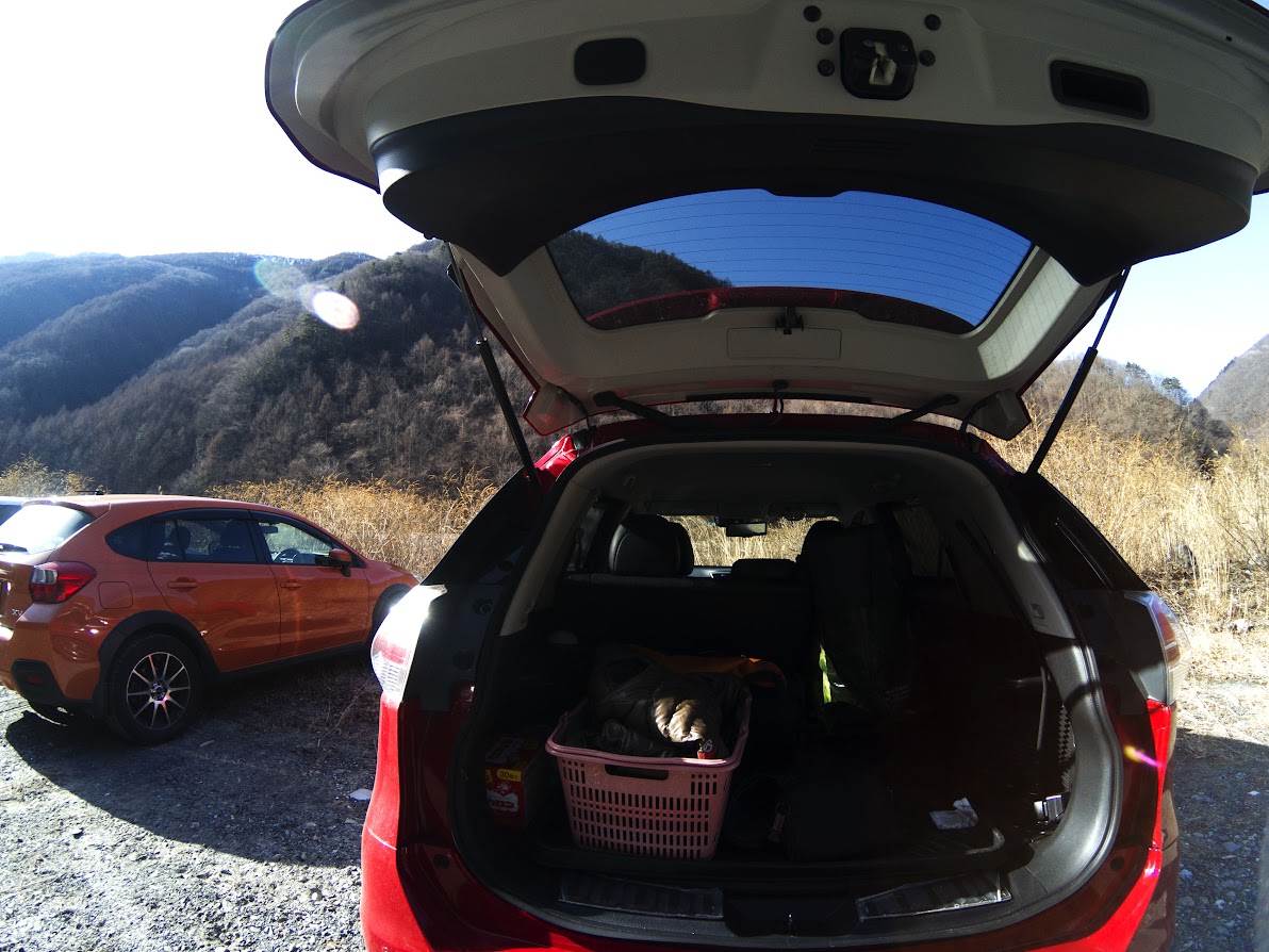
There were already a few dozen cars in the parking lot.

I could see the mountains of the Southern Alps as soon as I started walking. That's not my target for today.
It’s probably Mt. Komagatake, which I climbed 3 years ago.

I really hate these roads because they make my winter boots wear out faster than usual.
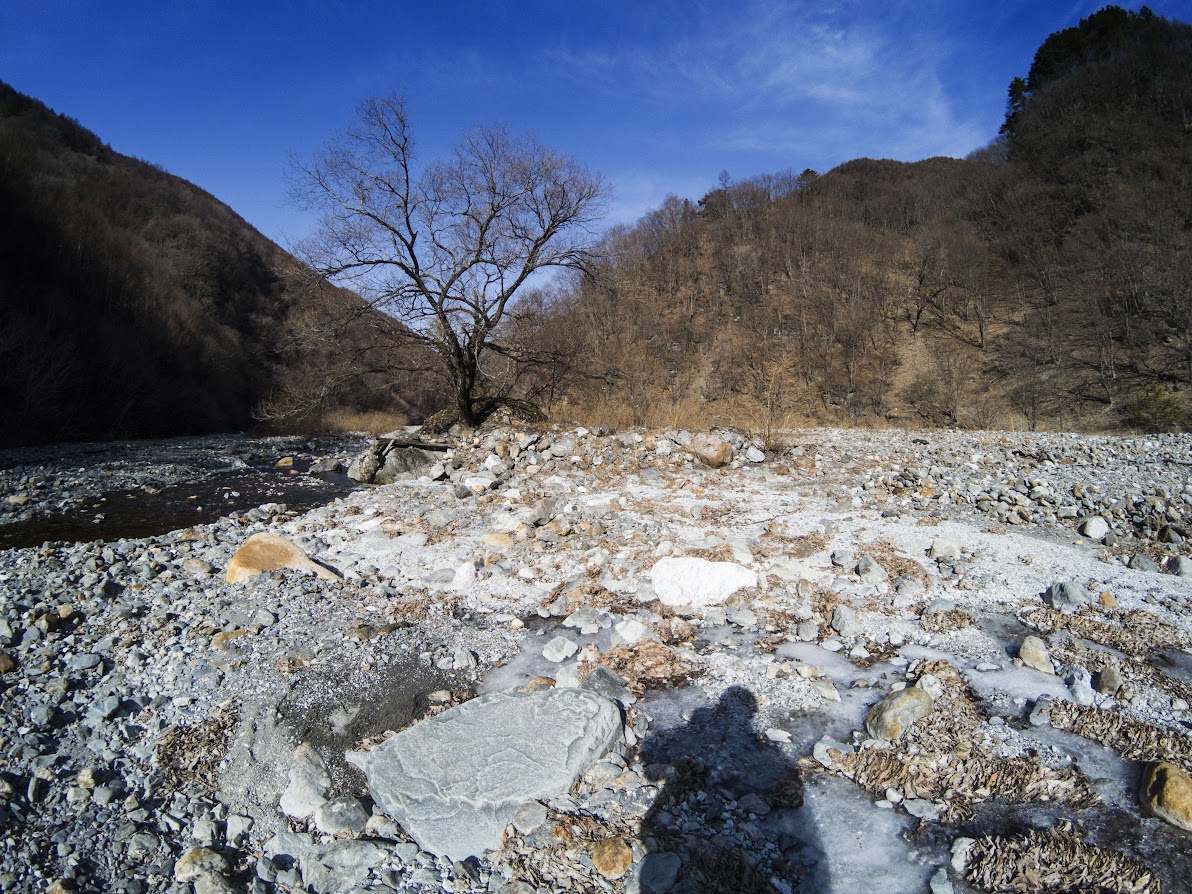
I had to cross a stream three different times and I had to walk an icy road.

After walking the gravel road for 2 hours, the climbing finally started.

The soles of my feet were getting sore from walking with clumps of snow that were collecting on my crampons.

Japanese Ganbare which is written on the tree means Good Luck!.

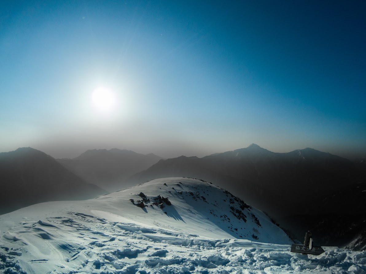
I almost got to today's target named Kitazawa-Toge.

I was flattening the snow to put up my tent in front of a lodge named Nagaei.

I love beer, but because it gives me gout, recently I’ve been getting more into Sake which is Japanese alcohol made from rice.
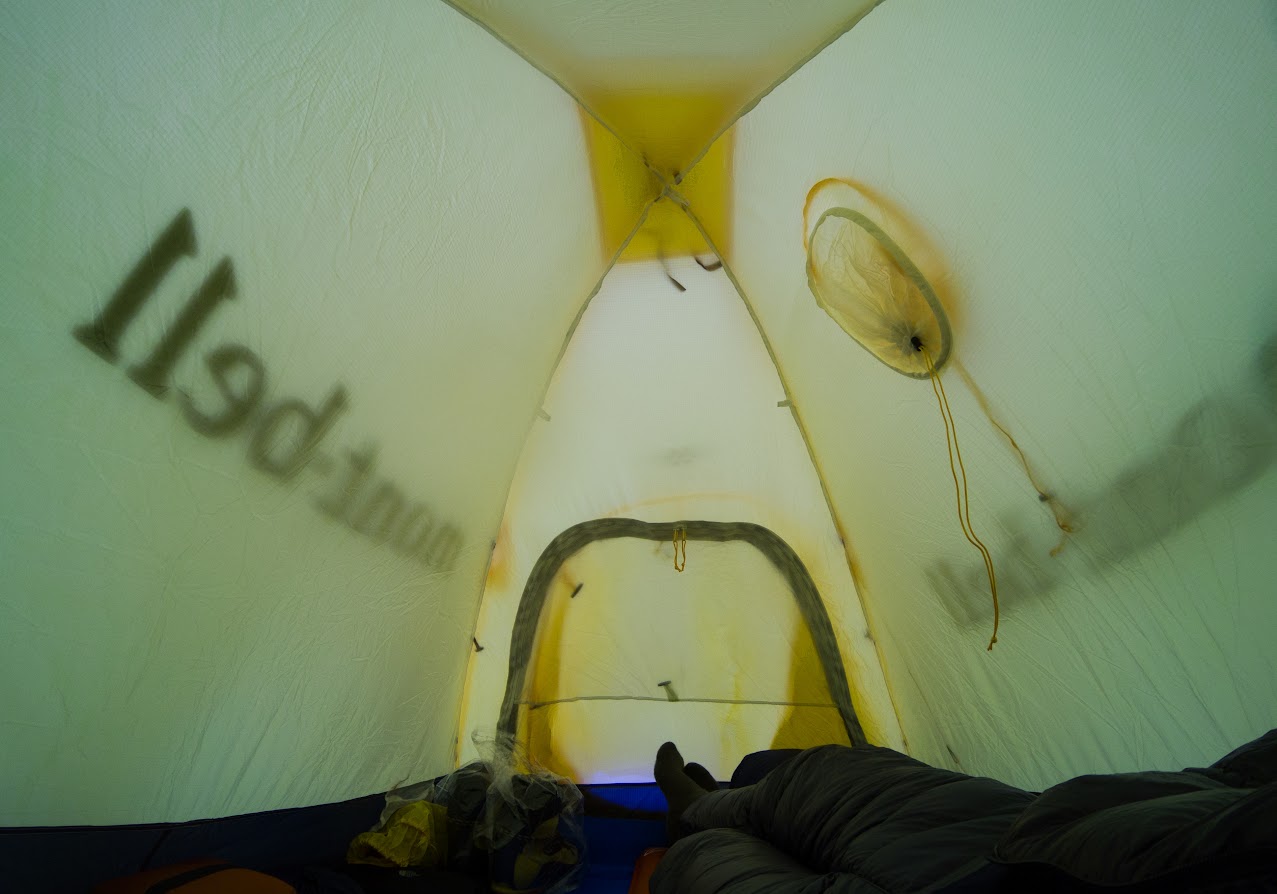
I was completely exhausted after walking 5 and a half hours, so I took a nap before eating dinner.

I got up at 3am and got started climbing at 3:50am.

The incline was pretty steep for a while, but I got my second wind when the sun started coming up.

Magic hour's lights everything in a beautiful way.

I climbed a half of course from Kitazawa-Toge. The wind would be stronger as I go towards the ridge line.

It was such a beautiful golden hour.

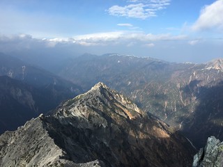
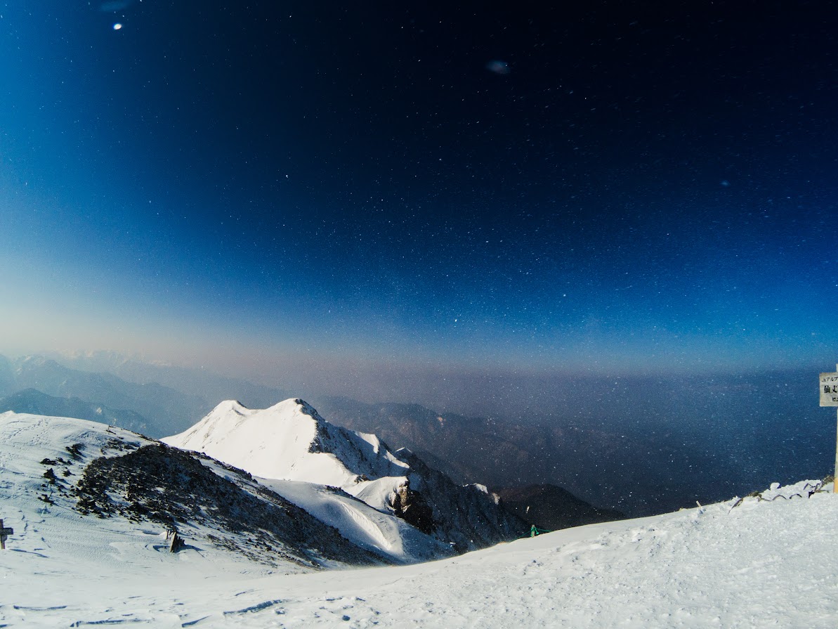
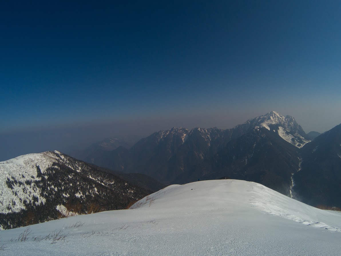
There is Mt. Kitadake which is the highest mountain in the Southern Alps of Japan.

I was confident in my muscle strength because I’ve been working out recently, but I also felt I needed much more aerobic exercise — not only lifting.

This area was covered with icy snow, so I could walk easily with my crampons.
The snow had completly changed into ice when I got to the ridge line.

This is the Mt. Sho-Senjogatake. I had to walk less 2 hour from here.

The icy snow was getting blown around by the strong wind.

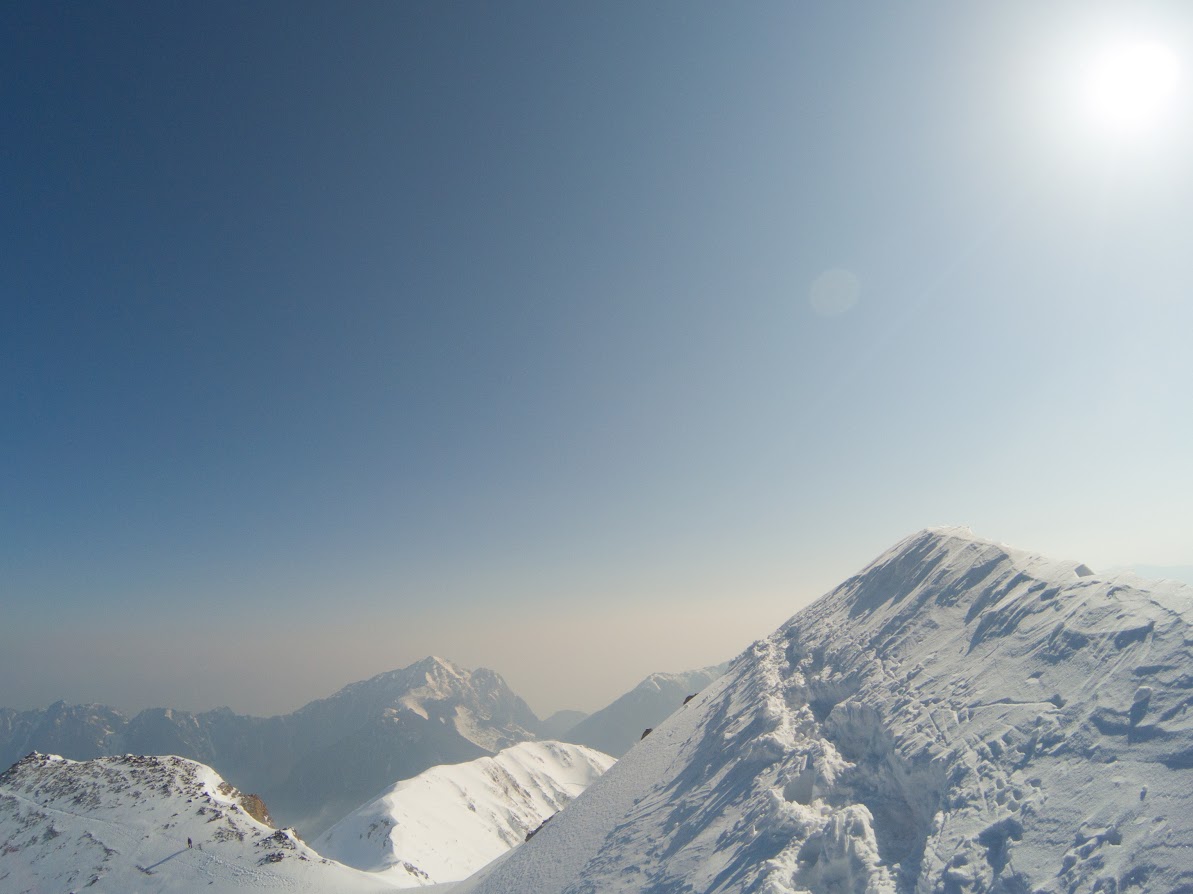
Here's my target for today. It looks very close but it’s still far off from here.

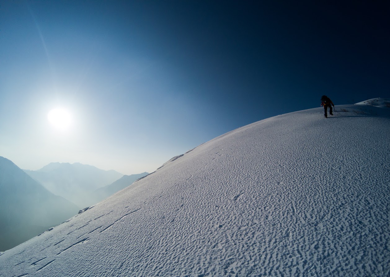
I rushed to the summit with my long legs.
I could see the highest mountain in the Southern Alps, Mt.Kitadake.
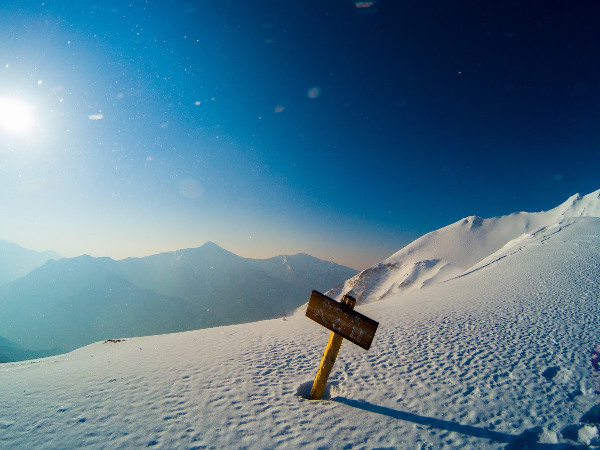
I had cleared 80% of the climb at this point.

There are some narrow up and down paths. It would be dangerous in bad weather.

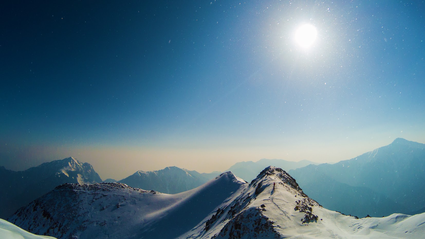
This is the climax of my climb. It's very close to the summit.

I was so happy. There are no words to express how good I felt. I was on cloud nine.

Someday, I'll get around to all of the Southern Alps mountains.
The wind was getting stronger, but the flowing snow is also beautiful, isn't it?

That's why I live to climb mountains.

It's the time that I have to go, I really don't want to though.
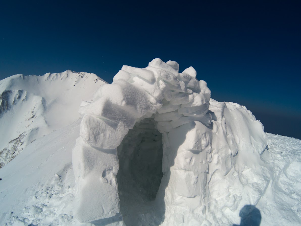
This is the 'Kamakura' in Japanese.(I don't know how I can say about that.) That was really well made. I'll practice to make that same one during this season.

That's a kind of art made by strong winds.
Up and down paths are so hard to walk, always.
Before I entered the forest, I enjoyed to see the Mt.Komagatake.

I came back to the climb start point. I hope to come here by BUS next time.

Good bye the Southern Alps. Thanks for showing me the fabulous scenery. See you in the summer season!