Mt. Echigo-sanzan climbing record
For this climb Exertion Level:★★★★★ Difficulty Level:★★★☆☆ Scenic Level:★★★☆☆
For this climb
Exertion Level:★★★★★
Difficulty Level:★★★☆☆
Scenic Level:★★★☆☆

This Mountain's Information
Schedule
- □ Duration:2 days and 1 night
- □ Term of Climbing:10.15.2016 ~ 10.16.2016
- □ Date at Summit: 10.16.2016
Weather
- □ Weather:Mostly Sunny
- □ Highest Temperature:25.0°C
- □ Lowest Temperature:2.0°C
Climbing Course
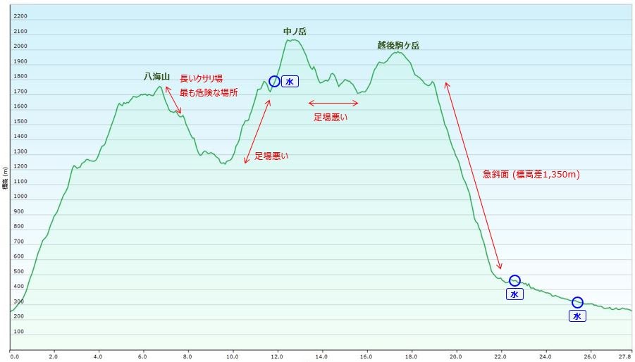
- □ Distance:33.2km
- □ Cumulative Elevation:3,000m
- □ Course:From Okura parking lot to Mt. Echigo-Komagatake via Mt. Hakkaisan and Mt. Nakanodake
- □ Further Information:Around Mt. Hakkaisan, the path was extremely narrow and steep. It is better to have rock climbing experience for some points, but I think it is not necessary. After Mt. Hakkaisan, the course is not intended for begginers. It was so hard to walk because I was interrupted by so many things like tree branches, rocks, bushes; It looks a jungle. Therefore I spent much more time climbing than I expected. Going down from Mt. Echigo-Komagatake was so steep, my climbing stick broke because it wasn't strong enough to sustain my body on such a steep path.
Approach to Starting Point
- □ Transportation:Car
- □ Time to Starting Point:About 4 hours one way by car.
- □ Further Information:From Omiya to Okuramori parking lot(Sakamoto shrine) via Kanetsu highway.
Location
The Map of Climbing Course

Altitude × Temperature
Download GPS Data
My Impressions
It had been raining for five consecutive weekends, but in the end nice weather finally came. I didn’t want to miss this chance to cimb to this mountain.
I hadn’t climbed with fully equipment for a long time, but this time the weather was good so I decided to camp on the mountain with my full equipment.
Echigo-Sanzan consists of three mountains: Hakkaisan,Nakanodake and Echigo-Komagatake. It was so tough to climb these mountain. I struggled with lack of water, high temperatures and a very long course.
The highest point of the mountain is 2,085m, but I started at 250m; Furthermore there were a lot of ups and downs, so overall, I had to climb about 3,000m and the distance was over 30km. I felt I needed more strength.
I expected the temperature to be lower because of the season, but to my surprise it was like summer. I felt dizzy and nauseous because I didn't eat enough food due to dehydration. But, I survived in the end. It was my birthday, so I though this wouldn’t be the best day to die, and I managed somehow.
Video Gallery
Photo Gallery
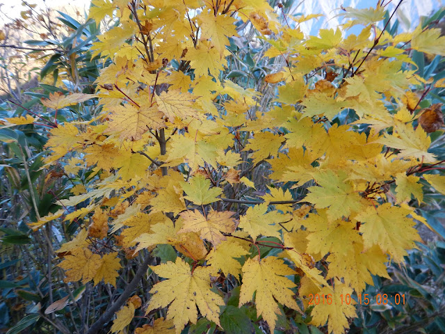
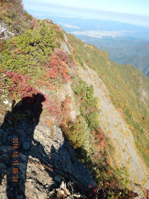
The fall colors have got started!

I was looking forward to walking these ridge-lines.
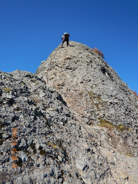
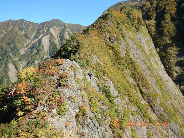
I could have taken a detour, but I decided to go for it. There were three rocks like that.

This climb's course has rock climbs like this. But there are ways to go arround.

Is that dude taking a piss at the summit of Mt. Hakkaisan?
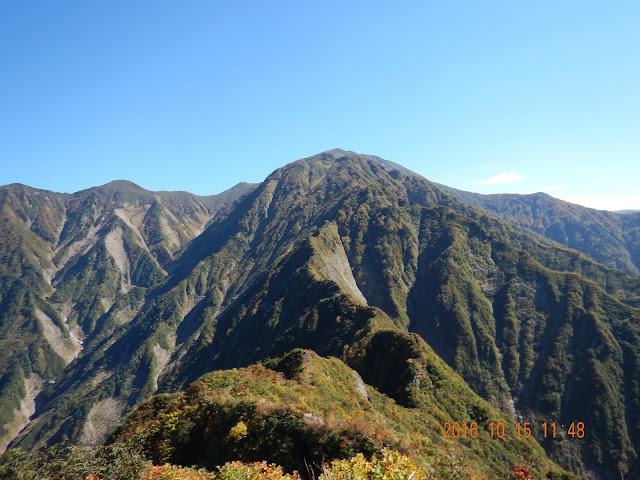
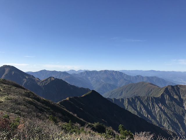
I couldn't see today's target, Mt. Nakanodake. It means it is far from here.

It was so hot like mid summer, but the leaves were gradually changing to yellow and red.

There was no place to avoid the sunshine. I was getting really thirsty, but I needed to ration my water supply.
Good views!
It was not as difficult as it looks.

This was where I stayed the first night. I'm going to stay there. It's at the summit of Mt. Nakanodake and it's a free of charge. It holds a few dozen people and the only provided in a space for your sleeping bag.

This was a special for me at the end of my first day, watching the sun-set, meditating on my future. It was precious and valuable time.

This was my last target, Mt. Echigo-Komagatake. The fall colors and golden hour's light gave it a soft warm red color.
I spent two days on these ridge lines. I felt great after doing it. But, I'll never do it again. I already know how tough it is.

Can you imagine how steep this path is? It is difficult to go down without sticks, so it was a problem that one of mine broke.
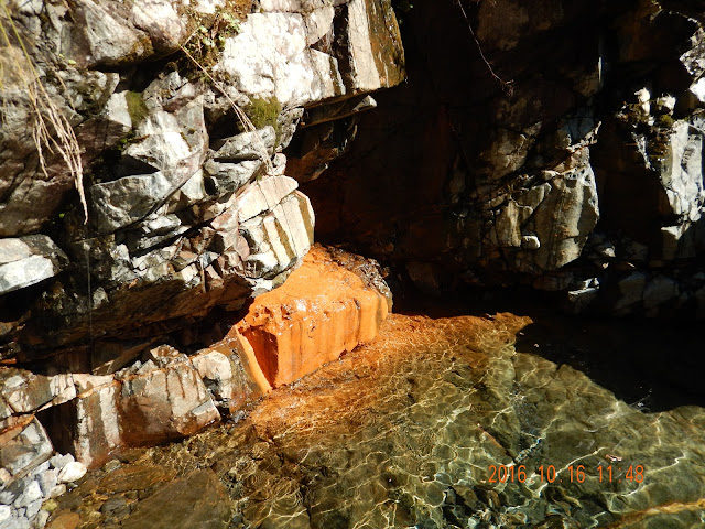
I found a paradise after climbing. I drank until I was full up because I was struggling with dehydration. I suppose the red coloring on the rock is caused by hotsprings which contains a lot of iron.